Chris' Genty

Chris' Genty

Friday, June 3, 2011

End of this Blog

Tomorrow I will drive to JFK to pick up Marianne. There will be a new blog of our trip to the Canadian Maritimes on

blog2.chrisbigler.net

This blog ends here. Thanks for reading, I hope you enjoyed it.

Chris Bigler

Location:
40.18017N 74.27722W 160 ft


Problems with the Fridge

Wednesday morning, I realized, that the fridge was not as cool as usually. The sites in this National Park are all slanted pretty much either towards the back (on one side of the hill) or towards the front (on the other side). Last night I had decided to take one of the forward tilted ones, since they are still comfortable to sleep. As it turned out, I slept well, but the fridge did not like to be tilted for almost 24 hours and almost gave up on me. I therefore decided to head on and have a chance to get it fixed if I need to.

So, I filled up with diesel and headed north east. The first part of the route was on excellent 4 lane roads across Virginia. Closer to Washington/DC the traffic got heavier and the roads worse. On the interstate around Washington and to Baltimore, traffic was really heavy and there was one construction site after the other. (A lot of signs said that the government gets work to the people and pay with the funds from the Recovery Act).

From Virginia through Washington/DC, Maryland and Delaware I finally arrived in New Jersey, where I found one of the few RV parks in New Jersey near Clarksboro. The fridge was only at 60F instead of 40F when I arrived, but there was still hope, that it got better over night and back on AC power.

After checking several times at night and in the morning, I realized, that something went wrong. In the morning, the temperature was still around 60F. The freezer compartments both held the stuff frozen, but the temperature there was only a little below freezing.


I decided to stay for two nights and fix this problem, since Marianne will arrive this Saturday and it would be nice if the fridge would work again. I checked my manuals, but found not too much information, but Google is my friend and I found a lot of very helpful information in RV blogs and user-groups online. I even found a complete technical descriptions how these absorber fridges work and how bad it is for them to be in a tilted position for longer periods of times. I even found a complete 50 page service manual for my Norcold 1210. I went through all the testing circles described in the manual but everything seem to work normally, it just did not cool enough. In several places online it was suggested to lay the fridge on the site for a couple of hours to eliminate air bubbles in the system. But this is very difficult with a fridge built in. And there is no way to remove it.

I also called three different RV shops, but they all offered some suggestions but had no time to look at it on short notice. My only hope therefore was, that it will recover over time. I put the fridge on MAX and left Friday morning for Freehold, my last stop on this trip. When traffic allowed, I shaked Genty as much as I could and kept hoping.

At Pine Cone Resort I had a water/electric site only, but after switching to a second site, at least the satellite was working and I could go online and make phonealls on Skype. After a couple of hours on AC again, I saw some improvements and towards the evening, my fridge was working properly again, showing a temp of 40F. What a relieve.


Tomorrow I will drive to JFK to pick up Marianne. There will be a new blog of our trip to the Canadian Maritimes on

blog2.chrisbigler.net

This blog ends here. Thanks for reading, I hope you enjoyed it.

Chris Bigler

Location:
40.18017N 74.27722W 160 ft


Tuesday, May 31, 2011

Shenandoah National Park

From Fancy Gap I took the Interstates for a 150 miles to speed up the process. Driving on the Blue Ridge Parkway is nice, but kind of remains the same and the lookouts are similar from one to another too. The weather was not so nice, so why not take the easy route. En route I got involved in a major traffic jam, where we stood pat for about 90 minutes. 21 state police cars and three ambulances went by and then it turned out that the accident was not even on the interstate but on the exit road.


After overnighting at Walmart in Waynesboro, I spent Tuesday in the Shenandoah National Park, where I found an overnight spot in the Loft Mountain Campground. The park itself is not much different than the Blue Ridge Parkway. Nice road over the mountains with big forests and lookouts left and right, but much of the same again. In the Shenandoah NP there I saw a few animals, including a deer which crossed right in front of me in the campground. In the afternoon I made an excursion with the Jeep and on the way back I collected some wood for a nice campfire in the evening.


On one of the outlooks I met a couple from Michigan who are hiking the Park in its entire length (107 miles) on the Apalachian Trail, which crosses the drive several times. Quite a hike !


Here are a few photos of the park.

Location:
38.24586N 78.66894W 3353 ft

Friday, May 27, 2011

Blue Ridge Parkway II

Yesterday (Thursday) I experienced another portion of the Blue Ridge Parkway. From Mt. Pisgah (MM 408) to the exit near Little Switzerland (MM 334) the road was again in good condition and traffic was low with the exception of the area around Asheville. Asheville is a good sized town with Interstates 40 and 26 crossing through town. On the 10 miles around Asheville one had the impression, that many drivers just wanted to "make" part of the Blue Ridge Parkway. Traffic increased tremendously around the town. There were less outlooks on this portion, but since the views kind of repeat a lot, I did not stop as many times as before. The most annoying thing was the many low hanging limbs banging on the various covers on the roof. So far I could not discover any major damage though.

The exit before Spruce Pine, where I planned to spend the night at Walmart, was Little Switzerland. I was interested to visiting that little town. The lady at the visitors center at Craggy Gardens said, that there was no problem and the road was good and continuing to Spruce Pine. So, off I went to Little Switzerland. Off the Parkway, there were only two roads, one was 226A heading to Marion, so I took the other one. After a few miles just behind a nice little church there was the sign "Dead end". I stopped and a couple of locals drove by and explained, that there was no such a road and I had to return to the Parkway. The only problem was, I had to turn around and that is not possible with the Jeep hooked up. So, I had to unhook, turn around and hook up again. Back on the parkway I directly went to Walmart in Spruce Pine. I still don't know what's there about Little Switzerland.

During the evening and all night a major thunderstorm was active in the area and the other morning there was a lot of fog on the hills. I therefore decided to use the major roads heading north. The first part of the road was 14% incline and there were a zillion warning signs and a 15mph speed limit for trucks. I usually honor all signs for trucks since they are there for a reason and my 40'000 lb combination is as heavy as a truck. After refueling in Marion, it was a 135 mile trip on I-40 and I-77 to Fancy Gap, where I-77 crosses the Parkway again and leaves the option open to continue there after the weekend.

In Fancy Gap there is an expensive KOA Kampground and the much cheaper Utt's campground, where I settled for a couple of nights. While it was dry most of the day, it was raining while I was setting up and during the entire evening. The campground is on a steep slope, but the sites are moreless level but on grass with very small gravel areas. They are definitely made for smaller rigs than mine. When leveling up, my rear left jack slipped off the wooden block and could not be moved up nor down. I had to use all the tricks in my toolbox to get the jack loose again, including filling the airbags and slowly moving Genty a few inches. Finally the jack retraced and I could start the leveling process again, this time with a solid gravel base under the wood block.

There are few photos here.

Location:
36.67576N 80.69017W 3007 ft

Wednesday, May 25, 2011

Blue Ridge Parkway I

After repairing the Datastorm internet system  for three hours in the parking lot at Walmart, Sylva, NC, I finally left after noon for the  BlueRidge Parkway.


I will travel on the Blue Ridge Parkway for the next couple of days. Since the mile markers go north to south and I travel south to north, I will drive "backwards". The "last" 20 miles are not passable with a big rig, since some tunnels are only 10-11 ft high. I started the trip at Balsam Gap, where The Great Smoky Expressway crosses the Blue Ridge Parkway.


It was an interesting drive uphill all the way to  6'047 ft, the highest point on the parkway. The pretty windy road is in perfect condition, although it is already over 70 years old (no commercial traffic !). There were many lookouts where I had no problem parking with my 61 ft long vehicle combination. Thanks to the higher altitude, the temperatures were very nice. Today's trip was in Nantahala National Forest and Pisgah National Forest. At Mt Pisgah is a hotel, restaurant and a nearby campground, where I settled for the night. No AT&T (for cell phone), no Verizon (air card), but my satellite dish is working again, so I have Internet and can blog and even watch a little TV. (Thanks to my huge battery bank which is fully charged from my solar panels)

Some of the photos can be seen here.

Location:
35.40323N 82.7577W 4944 ft

Monday, May 23, 2011

Great Smoky National Park

The Great Smoky National Park is basically a huge area of hills of all different altitudes with ridges, valleys, some rivers, etc. The area is wooded and covered by a huge variety of flowering plants.


There are several good roads in and through the park. Sunday I travelled from Cherokee to Newfound Gap (5'046 ft) and Clingmans Dome (6'643 ft) the highest point in the park. Due to pollution the view up there was not very impressive though. From the parking lot to the top of the mountain with the tower there is a steep trail of about one mile round trip for some exercise but little view. (The camera was set wrongly, that's why there are no photos from the top).

Some of the photos are available here.

Location:
35.44198N 83.33224W 1968 ft

Saturday, May 21, 2011

Across four states - heading east

After a few days in New Orleans, I travelled through Louisiana (LA), Mississippi (MS), Alabama (AL) and Georgia (GA) to North Carolina (NC). Mostly on interstates and in large forests travel was pretty easy and uneventful. I stayed at Wal-Marts and Lowe's along the interstates. The traffic was low, only around Atlanta traffic was very heavy.


Between Birmingham (AL) and Atlanta (GA) my odometer reached the first 100'000 miles.

In Georgia, 50 miles north of Atlanta, the ride changed. After a few hundred miles with more less no hills at all, the area started to get a little "hilly" to finally reach the Natahala National Forest. While the road still was mostly 4 lanes into the hills, at Andrews it went two lanes and one of a sudden I was in a small gorge with nothing but whitewater tourism, the Natahala Gorge. The windy road was about 25 miles and eventually turned into a 4 lane road and even an interstate again in the Great Smokey Mountains area, my goal for the moment.

In Whittier I found a Passport America campground (Fort Wilderness Campground and RV Park), which was difficult to find, almost impossible to reach (one 150° turn right outside of the park) and lousy inside. The internal roads are 7-8 ft wide and in bad condition. The utilities work though including my satellite. Since I am installed now, I will not change any more and stay for three nights But this campground cannot be recommended to anyone with a rig larger than 30 feet and if one needs the showers and restrooms - stay away they are dirty.

Location:
35.44198N    83.33224W    1968 ft

Friday, May 13, 2011

Goodby Abbeville

For a full month I was staying at Betty's RV Park in Abbeville. I enjoyed the Cajun cuisine and the adventures on Lake Martin and fishing and crabbing in the Vermilion Bay with Rocky. People and food in Cajun country are so different to the rest of the USA. I will come back.


Betty's RV Park is something special. The park has no amenities whatsoever, the sites are rather small, but you don't need any of these, since Betty, the owner and host makes up for everything. She is the most charming host you could think of. She is a real Cajun, she knows the area, the restaurants and she is a hell of a cook. Of course the number two attraction, right after Betty, is her Happy Hour every day at 4.30, when most RVers meet for chats and drinks and some crawfish festivals, etc.. Thank you Betty for the great time.


Today I left after 11am and drove via New Iberia and Highway 90 in 3.5 hours to New Orleans, where I made camp at Ponchartrain Landings. This is a nice, new RV park surrounded by yacht wharfs and some old run down harbour facilities.


Location:
30.02457N 90.03388W

Wednesday, May 11, 2011

Crabbing in Vermilion Bay

Today was a busy day. I went to a dentist for a little bite correction on one of my new crowns, then I had a haircut. On the way back to the Genty, Rocky called and asked whether I had fruit salad - I made some yesterday, so I invited him to come and get some. He likes my fruit salad. Then he invited me to go to look after his crab cages at 4pm.

Saturday, May 7, 2011

Fresh shrimp

We were sitting at Happy Hour when Betty returned from church. She told us, that half a mile up the road, a friend was just setting up for his fresh shrimp sale. Joel, Betty and I went there immediately to purchase some fresh seafood. The fisherman has about 500 pounds of fresh shrimp to sell. According to Betty, the word will go around town pretty quickly and he will sell everything in no time. We bought 10 pounds each. This sounds like a lot, but it is not.


Back at the RV park, we started working on these shrimps right away. While Joel already knew what to do, Betty taught me how to deal with these shrimps. I learned, that they can easily be prepared when that fresh. Just lift up a bunch and squeeze the body away from the heads, then throw away the heads. After this first round, the shrimps need to be peeled. They are quite slimy, so the shell goes away pretty easily.


My ice chest was full with the 30 pounds of shrimp to start the operation. At the end the chest was 2/3 full with heads and peeled shells. I took them back into Genty and washed the peeled shrimps and put them in bags and in the freezer. A part (still in the shell) went right on the barbecue for dinner (with Thai curry, paprika, salt, lime juice and olive oil).

A few photos can be seen here.

Location:
29.95295N    92.14324W    45 ft

Thursday, May 5, 2011

Betty's garden

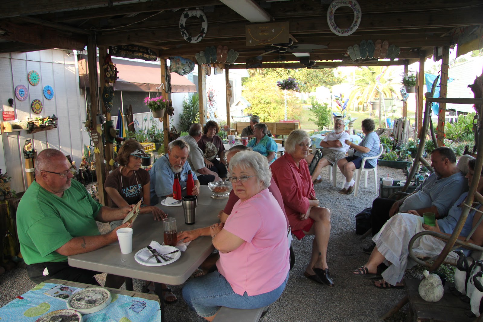
Today at Happy Hour I felt like having crawfish again. Betty was the only one liking this idea. I went to Maxi Mart and got 3 pounds for Betty and 5 pounds for me. Since it is going towards the end of the season, some of these crawdads are getting real big. There is more meat in the big ones, but the shells are hard and the meat is more difficult to remove. But the taste is still great. Those crawfish from Maxi Mart are just the best.


After dinner, Betty asked me to shoot a few pictures from her garden. The cactus which starts blooming was a gift from Mary-Beth and Betty will send the photos to her. Betty would also like to know what the name of the yellow flower is. Readers who know are welcome to comment in the shoutbox at the bottom of this blog or by e-mail. Thank you.

The photos of the day can be found here:

Location:
29.95295N 92.14324W 45 ft


Monday, May 2, 2011

Another Crawfish Dinner

The Crawfish Dinner we had last Friday was so good, that we had to repeat it tonight. Even more, since Char and John are planning to leave tomorrow morning and they love crawfish as much as I do. We were joined by a new couple who arrived today. Everybody had crawfish. We got them again from Maxi Mart. These guys just know how to boil crawfish. Several of us had 5 pounds, some had 3 pounds. This time I tried 5 pounds for the first time. I eat about 4 of them and left some for breakfast tomorrow.


After Happy Hour we said Good By to Char and John. We have become friends over the last 10 days. They are a really cool retired couple doing "half timing in their Airstream trailer". In the winter they live in Inverness, FL. They have invited me to visit them next winter. Maybe, I might even make it to Florida in the winter.

I have also made plans. I will stay another 10 days in Abbeville, then head to New Orleans for a few days before I head north to the New York City area to pick up Marianne.

You have seen enough crawfish photos, so there are no new ones.

Location:
29.95295N 92.14324W 45 ft

Sunday, May 1, 2011

Visiting the Dohertys

A week ago at the Farmers Market in Abbeville I met Betsi Doherty. She is originally from Stetten, Switzerland only 2.4 miles away from my hometown Fislisbach. She invited me for a visit and this visit took place today at their home. Betsi, Paul and her three sons live in a beautiful 4100 ft home on a full acre lot. Paul's parents live next door and they were also there for lunch.


Betsi made a nice "Swiss lunch" and for dessert a typical "Aargauer Rüeblitorte" - wonderful. After lunch we sat in the living room and chatted for a long time until Paul and the boys went out for a ballgame and I went back to the RV Park after Betsi showed me the house, where the three boys have the entire upper floor with bedroom each and a large school-room where they home-school during the week. I enjoyed this afternoon a lot.

Back at Bety's RV Park, Char and John, who are the only visitors still left were still having Happy Hour. We had a couple of drinks together before we went back to our RVs. It was already dark, when three firetrucks came by and stopped right outside of the RV park. It appeared that somebody had passed out at the trailer park on the other side of the road.

Some photos of the lunch are here.

Position:
29.95295N 92.14324W 45 ft

Festival International de Louisiane, Lafayette, LA


The Festival International de Luisiane in Lafayette celebrates its 25th year and takes place from April 27th to May 1st. Today it was time to check this out. Since nobody else from Betty's RV Park wanted to go, I went all by myself, which was good, so I could do and not do, what I wanted.


There are Music shows on various stages and a huge "Marché des Arts" (Arts market) and "Marché du monde" (World Market). While the pieces of art were nice, some even real nice and classy, looked the "World Market" more like any market. There was stuff offered from all over the country and many merchants tried to sell crap from Africa. The same crab you can see in any market wherever you go worldwide. There must be a big guy be behind all this and finance. They all have the same products (cheap African art for a relative high price - a ripoff for sure). The new gag they offer now is original African "shea butter". Nobody knows what this "butter" is for and it looks disgusting.


About hundred of stands were selling all kinds of food, mostly Louisiane kitchen. I tested "Alligator sausage with fries", crab cake with seafood etouffée and "Funnel cake" . I liked all three. I also bought 20 tickets for beverages. They are the only way to buy beverages at the festival (worth 50cents/piece).

I also listened to various music performances like "Keith Frank & de Soileau Zydeco Band" "The Duhks" and of course "MarchFourth Marching Band" from Portland, OR (for Swiss readers: a Super Guggemusig). Here is a sample video from their website.


All together I spent 6 hours at the festival. For the MarchFourth Marching Bank concert, which I enjoyed in full length, I even got my folding chair from the car (which was parked in a city street just five minutes from the festival area. It was a nice day around 76F until the end. It was cloudy and looked like rain all the time, but there were only a few sprinkles at one time.

Some photos from the festival are here.

Location:
29.95295N    92.14324W    45 ft

Friday, April 29, 2011

Crawfish at Happy Hour


This morning we said good by to Marvin, who left for the Black HIlls in South Dakota. Then I had a brunch with a nice steak and salad. In the afternoon three more RVs joined the party at Betty's. At the Happy Hour Betty took orders for the promised Crawfish Dinner. She ordered them from a local take away crawfish place. At 5.30h we got 3-5 pounds of crawfish each. They were wonderful and we enjoyed them a lot. As a matter of fact, they were the best I had so far. As one can even see on the pictures, these crawfish can even be used to play with.


Some more photos can be seen here.

Location:
29.95295N 92.14324W 45 ft

Thursday, April 28, 2011

Repair Comfort Hot

Nothing special to report today. I did some cleaning, some work on the computer and then I fixed an old problem. The "Comfort Hot" alternative heating system (in addition to the Hurricane Diesel Heater) began to get loose. Before I drop the entire thing to the ground, I decided to fix it properly. I bought two 5" bolts and nuts and washers. Then I drilled two holes through the 4" wall and fixed the heater with these two bolts. They can hardly been seen from the outside. Problem fixed.


Location:
29.95295N 92.14324W 45 ft

Tuesday, April 26, 2011

Rain in Abbeville

I had a very bad night. I did not sleep well. I don't know why. In the second half of the night it started raining. The rain got stronger and stronger and in the morning the RV Park looked like a swamp for a few hours, but the water seeped away  quickly. The Vermilion Tour was cancelled however and we all stayed at home. The weather got a little better, but a strong wind came up again.

There is not much other to report from today other that the group got together at Happy Hour as usual. Today was the first day here, that I left the party early.

From now on I am perpetuated in Betty website

No photos today

Location:
29.95295N 92.14324W 45 ft

Monday, April 25, 2011

Slowing down

Today I had to slow down. The last few days were so busy, I spent a lot of time in Betty's patio and had a ball, but nothing got done at home. I had to fix some website problems, clean lots of dishes, clean all the internal mirrors, get some laundry done, etc.

For dinner we were planning to get craw fish at Betty's and Rocky (our fisherman) promised to bring a vegetable boil. We found out that the craw fish place was closed today but Rocky brought his boil anyway. He just added some fish to the boil and we had a nice dinner with some Cole slow salad and my fruit salad. Then we had to finish a couple of bottles of booze. I went to Lafayette for more shot cups and we used them. A new bottle of Don Pedro Mexican Brandy also had to be opened to satisfy the demand (LOL).

Tomorrow will be another busy day, but with photos (hopefully).

Location:
29.95295N 92.14324W 45 ft

Sunday, April 24, 2011

Happy Easter

I was busy this morning preparing fruit salad for the Easter Pot Luck at Betty's RV Park. While I was doing this, Rocky the fisherman came by and invited me for a catfish spaghetti. But I told him about the pot luck and invited him to come there instead. There was enough food anyway. He then stayed a couple of hours in the Genty and used my computer to check his e-mail and show me some of his photos. Then he wanted to see some of my poker movies and he liked the final table of the PPT at Foxwoods 2004.

At 2pm about 20 people met at Betty's patio for the Easter Pot Luck. There was plenty of wonderful food including a turkey, ham, many dressings and sides and various deserts. I had made way too much fruit salad. Everybody liked it and I gave away some of it to take home. I also had an orange liquor from Mexico to add to the fruit salad and after the meal we did some shots with it and jokes and stories were told. Rocky was the "head story teller". We had a ball and stayed right into Happy Hour and trough it.

AT dusk Christine brought over a set of poker cards and chips and asked for a free lesson, what I gave to six of them. We stayed until after 9pm.

Unfortunately I did not have the camera with me all day.

Location:

29.95295N 92.14324W 45 ft

Saturday, April 23, 2011

Fishing in Vermilion Bay, LA


At noon Dale and I left with his truck to Rocky Rousos home in Abbeville to pick up Rocky and his trailer and boat. We went south to the Intracoastal Waterway where we used the public boat ramp to water his boat. It was very windy and the water was a little rough. We went about a couple of miles on the Intracoastal Waterway. In a tranquil area with some sort of reed Rocky fished for some bait. After he got a dozen smaller and larger fish, we went back to the Waterway to go check his lines he baited the day before.


These lines are fix installations of a thick line with hooks every 25 feet. Rocky stopped the boat and manually went from hook to hook. From the first hooks, the bait was taken by the crabs. The first three catfish he ad on the hooks were saltwater catfish. They are not good to eat, so Rocky released them immediately back in the water. Then he had some larger catfish on the hooks. On the four lines he still has out there, we collected 6 nice catfish of over 30 pounds. The will produce about 15 pounds of fillets.

The catfish went in the cooler and Rocky showed us some other areas including some camps and an oil rig drilling for natural gas.


On the way home, we bought some ice to keep the catfish cool for the next day. Rocky will fillet them tomorrow.

After four hours we were back at Betty's RV Park, just in time for the Happy Hour, where we could show a couple of pictures. All together an interesting day - Thank you Rocky.

Photos from the fishing trip can be found here:

Location:
29.95295N    92.14324W    45 ft

Farmers Market in Abbeville, LA


Today was Farmers Market at the square in Abbeville. At the Farmers Market you would expect lots of produce but here there were more art and handcraft stuff for sale plus a variety of food. Some of my friends from Betty's RV Park were selling hand painted cypress wood plates and jewelery. And then I was told, that a women from Switzerland was selling bread and Sunday bread (Zopf). I went there and met Betsi who is married here in Abbeville with Paul, but originates from Stetten Switzerland, about 3 miles away from Fislisbach, my hometown in Switzerland. Small world isn't it ! She had several pieces of handmade brad for sale and one only loaf of "Zopf" left. I decided to buy that, but Betsi gave it for me for free. Thank you Betsi, very nice of you. She even invited me for dinner sometimes next week.


After the visit to the market I went to Walmart for some groceries shopping. I will make a fruit salad fro tomorrows Easter Pot Luck at Betty's RV Park.

Some photos from the Farmers Market are available here.

Location:
29.95295N    92.14324W    45 ft

Friday, April 22, 2011

Catfish Fry


This morning my neighbors Dave + Mary came back from a fishing trip with Rocky. They had a cooler full of catfish which they offered for a catfish fry. Betty welcomed this and a few of us cut the catfish, peeled and cut some potatoes and set up the fry. At the Happy Hour George, Betty and others prepared the catfish fry. The cooker was really slow, but finally we each got a nice plate of fried catfish with potatoes, corn on the knob and various other sides brought in from other RVers.


Rocky was telling fishing stories. He is one hell of a story teller and the group enjoyed his stories. The party lasted until about 9pm - a little longer than the usual Happy Hour. I enjoyed the event a lot.

Betty's RV Park is almost full for the Easter weekend.

Some photos can be seen here.

Location:
29.95295N    92.14324W    45 ft

Monday, April 18, 2011

Friends leaving


Betty's RV park is not very busy any more. Most full timers who stayed here for the winter have already left. The last ones were Mary-Beth and Tony who left today heading north to Michigan, where they have a spot for the summer.

Although there are only a few rigs left, the Happy Hour is still going strong every day for a couple of hours. We also have new guests for coming in for a few days here and there. And

Location:
29.95295N 92.14324W 45 ft

Sunday, April 17, 2011

Crawfish dinner

At todays Happy Hour the group was really small. Most people have left the park and more will leave soon. The five of us shared three plates of different apetizers (most people bring an apetizer to the Happy Hour and everybody brings his own beverage). It got quite windy today and some needed to get jackets.


At the Happy Hour the five of us decided to go out for dinner and we chose Big Johns Seafood Patio in the neighbouring town Erath. Everybody ordered a different dish. Mary-Beth and I had crawfish. They were good, but not as good as last week at the same place. But this time we got a few pictures. A few of them can be seen here.

Location:
29.95295N    92.14324W    45 ft

Saturday, April 16, 2011

Jam Session at Touche's 2 J's, Maurice, LA

Shortly after 1pm some of us from Betty's RV Park left for a Jam Session played at Touche's 2J's in Maurice, LA. We enjoyed several hours of good Cajun music. About 20 musicians played in intervals and various combinations together. Several musicians played various instruments.


While the locals danced and drunk beers (in good quantities), the RVers just listened and drunk in way lesser quantities. But we all had fun and enjoyed a nice Saturday afternoon.


Some photos can be seen here.

Location:
29.95295N    92.14324W    45 ft

Friday, April 15, 2011

Betty's RV Park in Abbeville, LA

Not too much to report today. I did some cleaning and some laundry. At 4.30 there was again the usual Happy Hour, today with a little jam session.


Here is a photo of my site in the park.

A few photos of the park are stored here.

Location:
29.95295N    92.14324W    45 ft

Thursday, April 14, 2011

Lake Martin


Today we went on a swamp tour on Lake Martin. Five of us from Betty's RV Park went by car to Lake Martin, where a tour was organized. About a dozen people were on the boat. The tour around the bayou and the lake was interesting. We saw many birds and a few alligators.

On the way back I had my first Po Boy which is a piece of French bread filled with salad, mayo and grilled shrimps - pretty good.


Fotos of today can be found here.

Location:
29.95295N    92.14324W    45 ft

Wednesday, April 13, 2011

Abbeville, LA

After a bad night in the parking lot of the Isle of Capri Casino (very noisy and bright), I drove the last 90 miles to Abbeville, where I made camp for at least a week at Betty's RV Park.

After setting up and a long phone call with my son Roman it was time for the Happy Hour. It is a tradition at this RV park, that everybody meets for the Happy Hour. Although the park is not very well booked at this time, there were still at least a dozen people together. There were also some snacks and the folks from Halifax even brought a bottle of booze.

Later I checked out "Big Johns Seafood Patio" and had 3 lb of boiled crawfish. The crawfish were very good. It's been almost two years since I had the last ones, also in this area.

Some of the folks from the Happy Hour will go to a swamp tour tomorrow morning and have invited me to join them. More about this tour in tomorrows blog.

Location:
29.95295N    92.14324W    45 ft

Tuesday, April 12, 2011

Entering Louisiana

Another 172 miles on I-10 brought me to Louisiana. The ride was busy and especially the part around and straight through Houston with lots of traffic and some confusing signs. In Bayton, I lined up at the big truck wash and had Genty and the Jeep enjoying a body wash.

Right after the state border was a visitors center, where I collected some brochures. The workers there were not very helpful, since they did not seem to have much of a clue. All they knew were the names of a few hotels and restaurants, but what can you expect today.

Tomorrow I will drive the last 100 miles to Abbeville.

No photos today.

Location:
30.23654N 93.2493W 37 ft

Monday, April 11, 2011

Back on the road again

The job lasted a little longer than expected but after a test drive by the manager/owner Shane, at 4.15h I was finally on the road again. I still made another 150 miles including a refuel. I ended up at Walmart in Katy in the suburbs of Houston. Two more days and I will reach my next destination. I have already made a reservation at Betty's RV Park in Abbeville, LA, where I will stay for a week and enjoy Cajun food - mhhh.


29.78307N 95.80258W 142 ft

"Houston - we'v got a problem"

We are not in Houston yet, but we sure got a problem.


Last night, after I parked at Wal-Mart, I discovered that in the front right wheel case there is a large black spot all around. I checked and found that this must be from a leak and this needs to be fixed. I checked online and found two potential truck shops. Early in the morning I called them both and the second one (Womack Diesel) accepted me right away.


This looks like a family business and they took care of it right away and found, that there was a leak. This thing is leaking pretty good, he said and within an hour or so they started working on it. Taking everything apart, they found that the seal was just worn out pretty good and a replacement was at hand.

Within a few hours I will be on the way again.


Here are some photos.

Sunday, April 10, 2011

more I-10 in Texas

I drove from Sonora to Seguin on I-10 today. A total of 225 miles. It was warm today but still windy (not as much as the days before though) and the temps went up to 95F. The scenery changed quite a bit. From desert to bushland to forests to more populated areas with cities and farmland and then San Antonio. Lots of traffic, but no problem. You just have to hold the lane. Shortly after San Antionio I stopped at Walmart in Seguin where I bought groceries and will stay for the night.  It's still warm and windy again. Looks like another warm night.

No photos today.

Location:
29.56665N 97.94343W 521 ft

Saturday, April 9, 2011

Fort Lancaster

First thing this morning I went to Ft. Stockton to get Diesel, although there was a diesel pump at the RV Park, but they charged $4.14 - too much for Texas. I planned to go to the first pump for less than $4 and with easy access. Off the highway, I did not have to look long. They all had the same price $3.99 (!). After filling up, I did the long overdue air pressure check on all tires and then - surprise surprise - one of the rear tires had only 25 psi, where 120 would  have been OK. Something must have gone wrong. I tried to pump it up, but I could not get more than 90 psi out of this compressor. There were two possibilities, either I had lost the air on a recent leak and could not pump it up because it was still leaking a lot, or the air went out slowly over time and I did not check often enough (which would be the better case -still).
This I-10 exit is a real truck stop and luckily also had a truck tire shop. I went there and the mech pumped all tires up and the air held. He did not even charge for that. I gave him a Swiss army pocket knife and he was happy and so was I. (I checked again tonight after another 150 miles and the pressure is still good - lucky me).


At the exit for Sheffield I saw a sign for "Fort Lancaster Historical Site". I thought - why not and took that short 24 mile detour. There was a small Visitors Center, a large field with a few rock ruins and a small museum. Not really worth it, but it was a nice walk in the heat (low 90s) and I was the only visitor.

Back on I-10 I continued to one of the many Rest Areas. In Texas, RVs and trucks are allowed to stay overnight (parking, not camping - got the difference ? No slid outs, no chairs and barbecues etc. The guys in the Fiver right behind me do just that, but they probably don't know better, they are from British Columbia.


It is still 85 (after sunset) and I might enjoy a warm night.

There are a few pictures from the fort and the sunset at the "park" so see here.

Location:
30.61467N 100.7468W 2280 ft

Friday, April 8, 2011

Crossing Texas

After three days at this beautiful RV Park in the Guadalupe Mountains, I left and headed south to Van Horn first. In Van Horn I hit the I-10 which will bring me all the way across Texas over the next few days. The first stop on this trip is at the Saddleback Mountains RV Park in Balmorhea. This park has nice long Pull Throughs and they take Passport America. So I can stay for $10 for one night.


After dinner I left for a walk on the Nature Trail in the RV park, but my neighbour Rod (also a datastorm user) pointed me to a rattlesnake that just killed a bird. His tow vehicle also had a dead battery and I got my jumper cables and helped him starting the engine.


Location:
30.99211N    103.6647W    3030 ft

Thursday, April 7, 2011

Guadalupe Mountains National Park


It was stormy all night and it still is very windy today. Nonetheless I checked out the Visitors Center today. Then I walked the Pinery Trail behind the Visitors Center which goes to "The Pinery Butterfield Stage Station Ruins". Nice cacti and plants, but the ruins are nothing special.


Then I hiked a little on the Tejas Trail. When the trail began to get steeper it was time to return. Still a nice hike in a pretty area.

A few photos of the day can be seen here.

Location:
31.89654N 104.828W 5843 ft

Wednesday, April 6, 2011

Carlsbad Caverns National Park, NM

From Guadalupe Mountains NP in Texas I drove the 40+ miles eastwards (can you believe that ?) to the world famous Carlsbad Cavern NP in New Mexico through the Chihuahuan Desert. From White City, not a city, but a few motels, RV parks and shops, takes you a winding road through a desert canyon to the top of the former reef.


At the visitors center I got the necessary information and booked a 2pm guided tour to Kings Palace. During the previous two hours I toured the Big Room. I went down the 750' by elevator (1 min). Down there, i realized, that there is no chance to get reasonable photos without the tripod, so I went back up and picked up the tripod as well as a light jacket. The temperature in the caverns is a constant 56F with high humidity.

I returned from the big room just in time to go on the guided Kings Palace Tour. About 50 people, with all kind of cameras were on this tour. The four guys with tripods had been asked to form the tail of the tour to not obstruct the others with our tripods, which was fine.


Both tours were very interesting. Interested readers find a lot of technical information about the geology and history of the caverns here. Taking pictures was not easy, since there was very little light and one could not bring any light and flash lights are definitely not the right thing to do.

Whatever I got out of my equipment can be seen here.

Location:
31.89654N 104.828W 5843 ft

Tuesday, April 5, 2011

From El Paso to Pine Springs, TX

Todays drive brought me through El Paso to TX-180 (& TX-62) to the Guadalupe Mountains.. A few miles outside of El Paso there was only desert and little traffic for over 100 miles through the El Paso valley in the most western part of Texas.


The plan was to go to Carlsbad and visit the Carlsbad Taverns. However I discovered Guadalupe Mountains National Park. I have never heard of this park, so off to the Visitors Center, where I found out that they have a small campground with 8 sites for larger RVs. OK, I said, why not. There were only three really large RV sites (40' long), all the others are much smaller and some are occupied by smaller class C and class B RVs. There was just one long site vacant, and I took it and registered for three nights. (Only $4/night with NP Seniors Pass). This NP has no roads, just hiking trails. Maybe I will go hiking a little.


I just got a HIGH WIND WARNING on the computer (EASTERLY WINDS 35 TO 45 MPH WITH GUSTS TO 65 MPH. IMPACTS: HIGH PROFILE VEHICLES TRAVELING THROUGH THE MOUNTAINS SHOULD USE CAUTION AND REMAIN ALERT FOR HAZARDOUS DRIVING CONDITIONS.) -  nice

There are a few photos here.

Location:
31.89654N 104.828W 5843 ft